Category Archives: LOGBOOK

St Augustine

We spent the first night in Crooked River anchorage after a quick stop on Cumberland Island at Plum Orchard Mansion. There is a nice dock there, on the Brick hill River. I don’t know what the deal is with it, but nobody was around so we tied up. The mosquitos were so fierce we only stayed long enough to snap a few pictures. We will definitely have to go back later this winter, and spend some time. The mansion is just about a half mile above where the Brickhill converges with the ICW, actually the Cumberland River. The Crooked river empties into almost the same spot from the west. When going in, if you hug its north bank for a few hundred yards, there is ten or twelve feet of water in there with room to swing, a gentle current, and many less bugs.

dsc01269

dsc01270

dsc01272

dsc01273

dsc01274

dsc01275

dsc01287
Bath day on the Tolomato River. Another good anchorage about ten miles North of St Augustine.

dsc01292
Castillio de San Marcos, from the north mooring field where we spent the night.

dsc01294 Patty and Thad joined us for breakfast on Sunday morning. It was Thad’s birthday! We had pancakes with bacon, eggs and sausage as we watched the town come to life.

img_3680 There is a launch that runs every two hours from 8am-6pm. EXcept Sunday when the first run is at ten. So…

dsc01301
The trip home we had some fog in the mornings

dsc01309
Drydock at Mayport.
dsc01313
passing a fellow travelerdsc01315

This was “Brother” Jim’s third trip on the Spirit of St Simons. A talented teacher, artist, chef, story teller, and all around good company.

We saw a good bit of damage from Hurricane Matthew. At Fernandina we counted over a dozen good sized boats on the beach. The city dock was completely closed down. Fuel was available at Amelia Island Yacht Basin, but their channel is narrow and fairly shallow. We got in and out OK at low water, but with a deep draft you would be tide dependent.

A Good Time Was Had By All!

A nice afternoon sail with Buddy, Judi, Frank, Debbie, Rob and Suzy.

Northwester. Cool, clear and dry air, 12-15kts. Once you clear the Lanier Bridge, heading East, there is enough sea room to tack back and forth across the river without losing too much ground. On a flood tide, you don’t lose any ground, so it’s even better.

dsc01256

dsc01237

dsc01238

dsc01244

DCIM100GOPROGOPR1057.

Hurricane Season

dsc01212

The tires gave us some extra insurance against punctures. Thankfully they weren’t needed. The topsides paint is already scuffed up anyway, from the launch two years ago. Hopefully I can get some paint and graphics on soon.

It has been seventeen years since The Golden Isles’ last brush with a major storm. Hurricane Floyd, in 1999, made a very similar track to this years Hurricane Matthew, veering to the northeast at the last moment, only to brush by offshore, keeping us on the “good side” of the circulation.

Earlier, this September, the minimal hurricane Hermine came through, tracking from the southwest, out of the Gulf of Mexico.

Hermine actually did as much or more damage to local marine interests, mainly because the predominant wind was from the south. The large marinas here, Morningstar , and the condo docks next door, along with Brunswick Landing , all suffered because they are more exposed to that direction. Matthew’s winds, however, were mainly from the northeast, which is the most protected direction in each marina’s case.

Brunswick Landing,marina, where we are, had the least damage in Hermine, and virtually none from Matthew. There is no question that it is the most protected, but we were still all very lucky. Matthew happened to hit us at low tide. Since we have a tide range of six-eight feet, if the storm had passed over at high tide, the Cat 3 storm surge would have probably caused the floating docks to jump the pilings, setting whole rafts of boats adrift to bludgeon each other and everything else.

So far it has been a very good year for salvors, repair workers and tree surgeons.

Morningstar

Morningstar Marina.

In mid March we brought the Spirit of St Simons down from the North End of the island to a berth here at the old Golden Isles Marina.

DCIM100GOPROGOPR0583.

The Frederica River empties into St Simons Sound just below here, making it convenient for short trips. A breakwater gives some protection from the south.

DCIM100GOPROGOPR0585.

There is a daily turnover of interesting vessels, especially this time of year. The northward migration of yachts and cruisers is now in full swing.

DSC00735

DSC00765

DSC00738

DSC00794

DSC00797

Shoving off for Georgetown Exuma

DSC00753
DSC00807
DSC00808

Rich Brand, photographer, designer, explorer, free spirit. Headed north, from New Orleans!

DSC01036

DSC01037

I will update this post with more photos from time to time. Click pics for larger. Use your back button to continue.

More Outing Photos

Daysailing the Hampton River with Rhonda, Sonya, Mike, Donnie, Michael and Amanda.

Wind was fresh NNE, good for a nice long reach down river, with only a couple of tacks back up. We saw a large Sturgeon jump near the mouth of Old House Creek.

Click pics for larger. Back button to continue

Boat Pics Dec 12 2015 GoPro 311

IMG_1643

DSC00585

DSC00583

DSC00588

DSC00581

Francis Moore’s Journal

Following are a couple of excerpts from A Voyage to Georgia, Francis Moore’s account of his travels with the English colonists bound for St.Simons Island. We traced part of his route last week on the way up to Blackbeard Island.
………………………………………………………………………..
page 41
leaving Skidaway on the left, an the mouths of the Vernon and Ogeechee rivers on the right, we passed forward,and still kept through Channels,as before,sometimes crossing wide sounds (for the boatmen here call gulphs of the sea which run into the land, and the entrances of the rivers). There are 3 or 4 sounds to be passed, which in blowing weather are dangerous to those open boats. I believe, where we passed, St Catherine’s is above two leagues wide. The tides of flood carried us up along-side the islands and the tides of ebb down to the sea. Mr Ogelthorpe, being in haste, the men rowed night and day, and had no there rest than what they got when a snatch of wind favored us. They were all very willing, though we met with very boisterous weather. The master, Capt Ferguson, is perfectly acquainted with all the water passages, and in the darkest night never missed the way through the woods and marsh, though there are so many channels as to make a perfect labyrinth. The men vied with each other, who should be forwardest to please Mr. Otglethorpe. Indeed, he lightened their fatigue, by giving them refreshments, which he rather spared for himself than let them want. The indians, seeing the men hard labored, desired to take the oars, and rowed as well as any I ever saw, only differing from the others by taking a short and long stroke alternately, which they called the yamassee stroke. I found this was no new thing to the indians, they being accustomed to row their own canoes, boats made of a single tree hollowed, which they manage with great dexterity. When we came near the mouth of the Altamaha, we met a boat with Mr. Mackay and Mr. Cuthbert, (who is lieutenant of the Darien) coming from Darien to Savannah. They were very agreeably surprised to find Mr. Oglethorpe on board us. They returned to the Darien, taking Captain Dunbar with them, whilst we stood the shortest way to St. Simons. Mr Cuthbert told us, that one of the highlanders met with an orange tree on Duboys island; he was charmed with the color, but could not get to them buy reason of the height of the tree, which was so full of thorns, that there was no climbing it, so he cut it down and gathered some dozens….

March 1735-6 p49
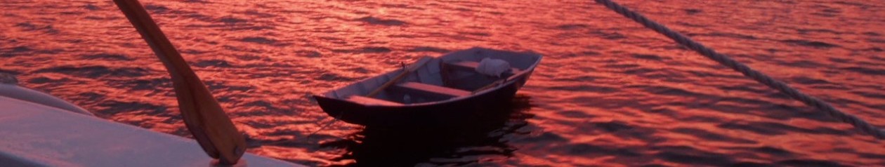
These periaugas are flat bottomed boats, carrying from 20-35 tons. They have a kind of forecastle and cabin but the rest open and no deck. They have two masts, which they can strike, and sails like schooners. They row generally with two oars only; but upon this occasion mr Oglethorpe ordered spare oars for each boat, by the addition of which, and the men of the colony rowing, they performed their voyage in five days, which single periaugau is often 14 days in doing.
Mr Oglethorpe accomopanying them with the scout boat, taking up the hinder most in tow, and making them keep together; and expedient for which was the putting all the strong beer on board one boat, which made the rest labour to keep up with that; for if they were not at the rendezvous at night, they lost their beer.

…………………………………………………………………..

It is about 85 statute miles from Frederica to Savannah River on the modern Intracoastal Waterway, or what would have been their inside passage more or less. Five days at 12 hours a day comes out to a little less than 1.5 miles per hour. Seventy five years later, John Couper’s slaves could row it in a day, in smaller boats and probably with more oarsmen- about 7 miles per hour. (faster than we in the Spirit of St Simons could motor it !)

I think the Orange tree story is interesting, having read that oranges were introduced into the Americas by the Spanish, and later established themselves naturally, though they are fragile in these parts because of the occasional hard winters. My question is: how did the tree that the Scotsman cut down in 1735 get to Doboy Island? Spanish missionaries? Indians? French? Another question is where did the name “Doboy” come from? Was Moore’s spelling “Duboys” a misspelling of Doboy or did the current spelling evolve from it? One could spend a lifetime just digging up the origin of the many curious names in this small piece of the world.

DSC00536

There is a nice anchorage
in the Back River that runs past Doboy Island, where it forks off of the ICW. It is open to the breezes and is relatively bug-free, with a clear view of Sapelo light to the Northeast. We saw a Bald Eagle in a tree on the southern tip of the island. You can anchor anywhere along there that is out of the waterway, but mind the strong current- especially the ebb. In a contrary wind it could get complicated.

The whole area there- the Back River, and both sides of Commodore Island as well as the shore of the North River, is strewn with small ballast Islands from the days of the timber ships. the ships would pitch the stones from within their holds prior to taking on cargo. Over time these piles of stone became wooded islands.

Blackbeard Island

DSC00524

The entrance to Blackbeard Creek has plenty of water. Going in, keep green day marker number “11”, which is part of the Sapelo entrance marker system, to STARBOARD. Depth there is 10 feet or so between it and the beach. We felt our way in after that, as there are no markers in the creek. It narrows down in places, but even with a 23 foot beam, we had no issues. The daggers were down six inches or so, which gives us a total draft of about two feet. It was low water at the time, and we only touched bottom in one place, where the passage runs up close against Sapelo Island and turns. From there you can see Nelson’s bluff straight ahead. the chart says four feet, but there is a bar there at the mouth of a branch creek that runs to the left, or north. At high water you should have no problems as the tide range is at least six feet. We dropped the hook just past the Ranger station dock at the bluff. The creek widens back out there, so there is room to swing with the tide on one anchor. It is very protected once you get in, but the entrance is wide open to the north and the whole fetch of Sapelo Sound, so that spot might get exciting in a blow.

DSC_0213

DSC_0235

Along the creek bluff there is a trail that runs eastward through the woods. It is only a few hundred yards to the ocean. We walked there the next morning and then turned north towards the Sapelo Sound entrance. The beach is in an erosion phase, with fifteen foot high sand cliffs, where hundreds of mature oaks and pines have toppled into the surf. At ebb tide the walking is not too bad, but when it comes back in you are often forced to wade around or climb over them. The island must be young, as islands go. We didn’t see much diversity in tree species, mostly palms, live oak and pines, with an occasional holly. The forest is a series of accreted ridges, or old dune lines separated by fresh water sloughs and/or valleys.

DSC00526

DSC00532

Blackbeard is very quiet, especially at night. The thump of the surf lulled us to sleep. Next time I might try going a little farther down past the Ranger dock, as the lights there are the only interruption in an otherwise perfect darkness.

DSC_0237

DSC00529

Good reading re Blackbeard and Sapelo history.

Can anyone identify this plant?

DSC00525

Brunswick Landing Marina

DSC00238
We’ve been holed up since mid- August here in Brunswick. It was the best hurricane plan we could think of. If you look at the map, we are located on the western-most part of the continental US Atlantic coast. The bight formed by the sea coast here gives the area a little more protection, so we seem to have better odds against a direct hit. Not that it doesn’t happen There is a lot of real estate though, between the East River and the open ocean further east. To the southwest, there is Andrews island, which is very high elevation, because it is mostly man made from dredge spoil. We feel reasonably safe here. This year’s storm season has been very tame so far.

The local weather is more tolerable now. Summer afternoon thunderstorms have given way to a general northeasterly flow. The monarchs are beginning to trickle through, and the sunlight is changing hue. So there is hope.
DSC00327
We have at least managed to get out for a few afternoon sails in the last week or so. The East River is wide and protected, with plenty of sea room to hoist the sails as soon as we are clear of the dock. It is a thrill to glide past the town waterfront under sail alone. Catamarans are generally quicker, but we had a humbling experience on Saturday out in the sound, when a production monohull smoked past us on a close reach, as we fiddled with the outhaul and the lazy jacks. There is much to learn yet about tuning and sailing this boat!

A small community of live-aboards tie up here, mostly waiting for cooler weather to head south. Speaking of that, we saw two more spoonbills roosting on quarantine island on Sept 19th, and several more in the Turtle River since then. I had no idea they stayed around this long. We have noticed more of these beautiful pink birds around here this year than I can remember. Last November on the trip to Merritt Island, we didn’t see any until we got into Mosquito Lagoon.
DSC00332
You can see quarantine Island just east of the Sydney Lanier Bridge.It is that small clump of trees on the north side of the Brunswick river. They used to detain inbound sailors there around the turn of the twentieth century. Earlier, it was a popular dumping ground for ship’s ballast stones before taking on cargo in the port. There is a private house there now, and a dock.
DSC00286
Just across the river at the marina is a good level spot to dry out at low tide, and the price is right! We had a pretty good mess of barnacles to scrape off after eleven months. It is hard to believe she has been in the water almost a year.DSC00284