


March 1774
William Bartram’s Travels
Part II ch 1
excerpt:
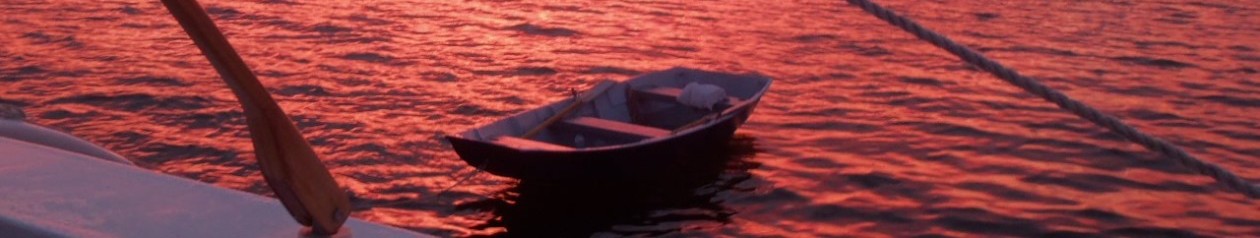
…At length I doubled the utmost south point of St. Simon’s, which forms the north cape of the south channel of the great river Alatamaha. The sound, just within this cape, forms an excellent bay, or cove, on the south end of the island, on the opposite side of which I beheld a house and farm, where I soon arrived. This delightful habitation was situated in the midst of a spacious grove of Live Oaks and Palms, near the strand of the bay, commanding a view of the inlet. A cool area surrounded the low but convenient buildings, from whence, through the groves, was a spacious avenue into the island, terminated by a large savanna; each side of the avenue was lined with bee-hives, to the number of fifty or sixty; they seemed to be well peopled, and exhibited a lively image of a colony that has attained to a state of power and affluence, by the practice of virtue and industry.
WHEN I approached the house, the good man, who was reclining on a bear-skin, spread under the shade of a Live Oak, smoking his pipe, rose and saluted me: “Welcome, stranger, I am indulging the rational dictates of nature, taking a little rest, having just come in from the chace and fishing.” After some conversation and rest, his servant brought a bowl of honey and water, a very refreshing and agreeable liquor, of which I drank. On rising to take my departure, he objected, and
Page 61
requested me to stay and dine with him; and on my pleading, for excuse, the necessity of my being at Frederica, “Yet, I pray you, stay a little, I will soon have some refreshment for you.” Presently was laid before us a plentiful repast of venison, &c. our drink being honey and water, strengthened by the addition of brandy. Our rural table was spread under the shadow of Oaks, Palms, and Sweet Bays, fanned by the lively salubrious breezes wafted from the spicy groves. Our music was the responsive love-lays of the painted nonpareil, and the alert and gay mockbird; whilst the brilliant humming-bird darted through the flowery groves, suspended in air, and drank nectar from the flowers of the yellow Jasmine, Lonicera, Andromeda, and sweet Azalea….

Following are a couple of excerpts from A Voyage to Georgia, Francis Moore’s account of his travels with the English colonists bound for St.Simons Island. We traced part of his route last week on the way up to Blackbeard Island.
………………………………………………………………………..
page 41
leaving Skidaway on the left, an the mouths of the Vernon and Ogeechee rivers on the right, we passed forward,and still kept through Channels,as before,sometimes crossing wide sounds (for the boatmen here call gulphs of the sea which run into the land, and the entrances of the rivers). There are 3 or 4 sounds to be passed, which in blowing weather are dangerous to those open boats. I believe, where we passed, St Catherine’s is above two leagues wide. The tides of flood carried us up along-side the islands and the tides of ebb down to the sea. Mr Ogelthorpe, being in haste, the men rowed night and day, and had no there rest than what they got when a snatch of wind favored us. They were all very willing, though we met with very boisterous weather. The master, Capt Ferguson, is perfectly acquainted with all the water passages, and in the darkest night never missed the way through the woods and marsh, though there are so many channels as to make a perfect labyrinth. The men vied with each other, who should be forwardest to please Mr. Otglethorpe. Indeed, he lightened their fatigue, by giving them refreshments, which he rather spared for himself than let them want. The indians, seeing the men hard labored, desired to take the oars, and rowed as well as any I ever saw, only differing from the others by taking a short and long stroke alternately, which they called the yamassee stroke. I found this was no new thing to the indians, they being accustomed to row their own canoes, boats made of a single tree hollowed, which they manage with great dexterity. When we came near the mouth of the Altamaha, we met a boat with Mr. Mackay and Mr. Cuthbert, (who is lieutenant of the Darien) coming from Darien to Savannah. They were very agreeably surprised to find Mr. Oglethorpe on board us. They returned to the Darien, taking Captain Dunbar with them, whilst we stood the shortest way to St. Simons. Mr Cuthbert told us, that one of the highlanders met with an orange tree on Duboys island; he was charmed with the color, but could not get to them buy reason of the height of the tree, which was so full of thorns, that there was no climbing it, so he cut it down and gathered some dozens….
March 1735-6 p49
These periaugas are flat bottomed boats, carrying from 20-35 tons. They have a kind of forecastle and cabin but the rest open and no deck. They have two masts, which they can strike, and sails like schooners. They row generally with two oars only; but upon this occasion mr Oglethorpe ordered spare oars for each boat, by the addition of which, and the men of the colony rowing, they performed their voyage in five days, which single periaugau is often 14 days in doing.
Mr Oglethorpe accomopanying them with the scout boat, taking up the hinder most in tow, and making them keep together; and expedient for which was the putting all the strong beer on board one boat, which made the rest labour to keep up with that; for if they were not at the rendezvous at night, they lost their beer.
…………………………………………………………………..
It is about 85 statute miles from Frederica to Savannah River on the modern Intracoastal Waterway, or what would have been their inside passage more or less. Five days at 12 hours a day comes out to a little less than 1.5 miles per hour. Seventy five years later, John Couper’s slaves could row it in a day, in smaller boats and probably with more oarsmen- about 7 miles per hour. (faster than we in the Spirit of St Simons could motor it !)
I think the Orange tree story is interesting, having read that oranges were introduced into the Americas by the Spanish, and later established themselves naturally, though they are fragile in these parts because of the occasional hard winters. My question is: how did the tree that the Scotsman cut down in 1735 get to Doboy Island? Spanish missionaries? Indians? French? Another question is where did the name “Doboy” come from? Was Moore’s spelling “Duboys” a misspelling of Doboy or did the current spelling evolve from it? One could spend a lifetime just digging up the origin of the many curious names in this small piece of the world.

There is a nice anchorage
in the Back River that runs past Doboy Island, where it forks off of the ICW. It is open to the breezes and is relatively bug-free, with a clear view of Sapelo light to the Northeast. We saw a Bald Eagle in a tree on the southern tip of the island. You can anchor anywhere along there that is out of the waterway, but mind the strong current- especially the ebb. In a contrary wind it could get complicated.
The whole area there- the Back River, and both sides of Commodore Island as well as the shore of the North River, is strewn with small ballast Islands from the days of the timber ships. the ships would pitch the stones from within their holds prior to taking on cargo. Over time these piles of stone became wooded islands.

The entrance to Blackbeard Creek has plenty of water. Going in, keep green day marker number “11”, which is part of the Sapelo entrance marker system, to STARBOARD. Depth there is 10 feet or so between it and the beach. We felt our way in after that, as there are no markers in the creek. It narrows down in places, but even with a 23 foot beam, we had no issues. The daggers were down six inches or so, which gives us a total draft of about two feet. It was low water at the time, and we only touched bottom in one place, where the passage runs up close against Sapelo Island and turns. From there you can see Nelson’s bluff straight ahead. the chart says four feet, but there is a bar there at the mouth of a branch creek that runs to the left, or north. At high water you should have no problems as the tide range is at least six feet. We dropped the hook just past the Ranger station dock at the bluff. The creek widens back out there, so there is room to swing with the tide on one anchor. It is very protected once you get in, but the entrance is wide open to the north and the whole fetch of Sapelo Sound, so that spot might get exciting in a blow.


Along the creek bluff there is a trail that runs eastward through the woods. It is only a few hundred yards to the ocean. We walked there the next morning and then turned north towards the Sapelo Sound entrance. The beach is in an erosion phase, with fifteen foot high sand cliffs, where hundreds of mature oaks and pines have toppled into the surf. At ebb tide the walking is not too bad, but when it comes back in you are often forced to wade around or climb over them. The island must be young, as islands go. We didn’t see much diversity in tree species, mostly palms, live oak and pines, with an occasional holly. The forest is a series of accreted ridges, or old dune lines separated by fresh water sloughs and/or valleys.


Blackbeard is very quiet, especially at night. The thump of the surf lulled us to sleep. Next time I might try going a little farther down past the Ranger dock, as the lights there are the only interruption in an otherwise perfect darkness.


Good reading re Blackbeard and Sapelo history.
Can anyone identify this plant?


Local Spoonbill fans probably notice a few birds visiting each summer. Every year around mid July you can spot one from the St Simons Island Causeway, down around Terry Creek. Often when crossing the Brunswick River Bridge on 17 going south I have noticed one or two wading in a tidal pond there just on the other side of the Jekyll Causeway entrance. This is the first year I have seen them in Jones Creek. Hopefully, that is a good sign. For the record, this juvenile was in Jones Creek on August 13, 2015.